The North Watch: Adventures in the Narumbeki Gap
A Southlands Sandbox.
Chapter One: Introduction:
T’Balla The Innkeeper stands his porch peering into the distance, saying to himself in practiced ritual, “Greetings and safe travels to all upon this wondrous road. I gaze upon your caravan as it winds back and forth along the foothills. Soon you shall arrive at my doorstep. The Wondrous Vista has been run by our family for as long as the Lion Road has connected north to south. Look across the road to our partner the mighty fortress, North Watch, that also watches over your travel through this most interesting of lands. Farewells and safe travels to you all when you depart on the morrow refreshed and well fed of course. For you, traveler, are always welcome at the Wondrous Vista.”
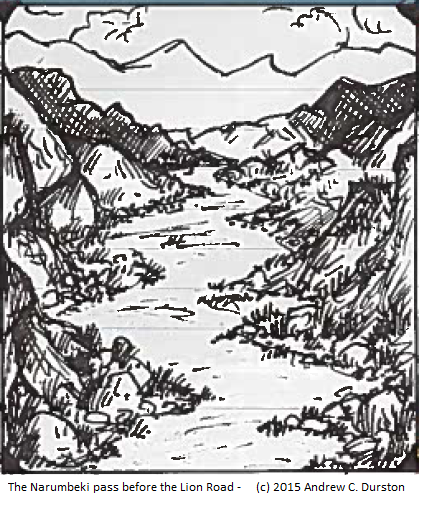
Centuries ago the Lion Road began in southwest Nuria Natal and followed the trail of many intrepid adventurers and explorers who made their way to the unknown center of the Southlands. Experience determined their path, such as skirting the dangerous jungles of Kush. After passing through the MBazha mountains avoiding ambush and avalanche, by way of mountain pass and narrow valley, the plains of the Narumbeki were discovered.
The surviving Nurians met the warriors of the Narumbeki and discovered a like-minded folk, at least as far as commerce was concerned. At first, contact between the two nations was irregular, for small groups fell prey to the hazards of the journey; becoming lost, being attacked or simply vanishing completely. The merchants of Nuria Natal chose to committed themselves to this enterprise and organized heavily armed and well led caravans. Regular trade began soon afterwards, necessitating the establishment of trading posts and caravansaries along the path which when widened and flattened became a road.
From Southlands (c) 2015 Kobold Press
“The Lion Road begins in Corremel. It brings slaves and raw goods, such as rod stock or lumber, approximately 500 miles to the temples of Per-Xor. Then, it winds southwest for 900 miles, to the gap on the edge of Kush. This is a dangerous path, for the creatures of Kush frequently raid into the valley of the Gap. The Lion Road uses the Pyramid of Khensu as an important landmark; no caravan stops near the cursed structure, believing the area haunted by hungering undead. Expeditions returning from the Lion Road bring back dwarvish metalwork, exotic hides, and, occasionally, strange texts written on a bark-like paper from Lignas.”
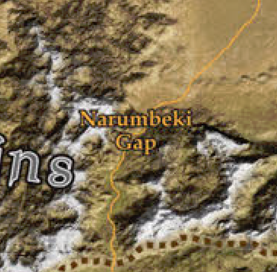
The Narumbeki gap runs through the eastern half of the MBazha mountains, north of Narumbeki and south of the desert, northwest of the Yawchaka Jungle of Kush. The Lion Road runs through narrow mountain valleys, after ascending or descending the foothills at each end. The route runs from the nation of Narumbeki in the south, starting in Akanda Chegutu to the nation of Nuria Natal in the north, its first stop being the oasis at Qitta, east of the Fassili mountains.
The Narumbeki gap and surrounds (~250 mile square)
(c) 2015 Kobold Press
T’Balla The Innkeeper continues: “The Wondrous Vista brings you cool shade in the summer and hot fires in winter. The mountain air is crisp and good for the soul. The water of the streams swells in spring from the melting of the snowy white robes worn by the mighty peaks that surround us. Quiet fishers and careful hunters may find fair game in the valleys and vales off of the Road. We gladly roast and bake their catch for our honored visitors. Should you wish to explore, I can recommend a trusted ranger or two.”
The Lion Road is well-traveled, but as history has shown, dangerous. Heavily guarded caravans move from camp to camp, relying on fortresses, such as North Watch, to give their soldiers a break from endless nights of patrols and watches. The valleys of the Gap are subject to incursions by both the spawn of the Green Walker and lesser beasts of the mountains themselves. When the seasons turn cold, snow and ice, in the form of avalanche and storm, threaten those that remain on the Road. The flat stretches north of the gap feature more mundane hazards such as bandits and windstorms, the latter enhanced during the heat of summer.
Walking along the broad porch that runs around the Wondrous Vista, T’Balla grandly gestures as he describes, “We stand at a crossing that divides all about us into four. The Lion Road, from south to north, is one bar. The foothills of great Mbazha is the other. Four quarters and we be at the center. There, southwest, the peaceful slumbering majesty of the Mbazha’s tallest peaks. There, northwest, the steam and fire of the young fierce Fassili spires.” He turns, “here, to the northeast, the wide and mostly barren spaces of the plains south of our northern neighbors. And finally, southeast, the lesser Mbazha whose valleys are filled with green evils seeping from the depths of Kush beyond. All about us and those upon the Lion Road”
The five areas of the Narumbeki Gap
(c) 2015 Kobold Press
I plan to present Narumbeki Gap in a series of seven articles, including this one, the introduction. The next five will cover the five regions of the Gap, as described and shown above. The first of those will be the lands astride and locations along the Lion Road. The last post will wrap up this endeavor including final thoughts and responses to any comments and questions received.
Each region of the Gap will feature the following sections:
T’Balla, tall but greying, smiles with arms spread wide, “But my apologies tired travelers. I am sure you would rather see your rooms and test the softness of our beds. But then you must join us for dinner, for every day at the Wondrous Vista is a feast and ends in a banquet.” He leads you into the Inn where his family and staff stand waiting.